Tuesday, December 20, 2022

Cozumel Thanksgiving

Going to make this kinda short because the video is kinda long. Please take a serene few minutes to watch the video recap of the trip here.

Two weeks in Cozumel over Thanksgiving and the week after. Jenny Batten flew down with me and stayed 10 days.

Jill Rendall joined us after Thanksgiving and stayed until our departure on December 3rd.

This was a totally stress-free vacation. We didn't rent a car and mostly stayed at the Coral Princess where the snorkeling was off the charts good. Water was crystal clear. When it rained, it rained over night or briefly. I got in several runs and even had Jenny running with me a few times. And she gave me swimming pointers.

We went to a new-for-us beach club, Buccanos, that was so fantastic. The food was amazing and the beach and water were crazy nice.

We hit our favorite spots...Hotel B, Casa Denis, key lime pie store, Casa Mission, Guido's, and Pancho's Backyard.

Jill and I took a snorkel sailing excursion with an amazing group of women. The photos and some videos of jib flying are here.

Monday, November 7, 2022

Boundary Waters 2022

sunrise

This year's Boundary Waters trip was very different. Our original paddle and portage trip was cancelled. So we opted for a late Fall trip up north to Jenny and Andrew's cabin situated next to Gust Lake just off The Grade.

We had no idea the weather would be as amazingly fantastic as it was. It was very late in the season, and it could have as easily been freezing temps instead of 60's.

Maggie cat

Our foursome became a five-some with the addition of Maggie, my cat. Maggie has been to the cabin before, so she fit right in.

Brian cooked awesome meals...meatloaf one night and an incredible frittata another night. I made an apple pie with Jenny's apples. Reading (our normal BWCA activity) and puzzling were always active.

There was an excursion to Grand Marais on Sunday. We collected rocks for a project Jenny was working on. Also, a stop at the local bookstore resulted in several purchases,

I climbed up the mountain the hard way :-)

A hiking adventure at Oberg Mountain on Monday brought us back the big lake - Lake Superior. The park rangers had arranged a "monster" hike along the path. It was very clever and educational.

There were high hopes for northern lights (aurora) as the ratings were very high all weekend. However, no luck seeing northern lights, the stars were out in full force especially with the moon setting very early.

As is my thing these days, I created a video of the trip. Click here to view in YouTube.

Tuesday, October 11, 2022

Leaf Peeping

Landscape Arboretum
Had the opportunity to visit the University of Minnesota's Landscape Arboretum in Chaska, Minnesota. Friends Bud, Pam, and Susan strolled the Three Mile Walk enjoying the amazing sunny day with all the Fall colors.

Also, there were pumpkins, scarecrows, and a stop at the apple barn.


Highland Park Water Tower
The following day, Bud, Susan and I went to the Highland Park Water Tower in St. Paul. It is open to visitors just twice a year. Once you climb the 150 steps to the top, there are spectacular views of both Twin Cities (Minneapolis and St. Paul) and surrounding areas.

Monday, September 26, 2022

Fall Biking - Camping Trip

 I forgot to write my usual story to accompany photos and the video. So here is a hopefully a short story of last week's biking-camping trip.

First a clarification...we did not bike with our camping gear. We drove to the bike trails and drove to the camp sites. Two guys in their sixties do not need to be overdoing anything :-)

We (my friend Bud and I) first went to Albany, Minnesota. It is just off I-94 between St. Cloud and Sauk Centre. Albany is along the Lake Wobegon Trail which has a side route that connects to the Soo Line Trail. The Soo Line Trail goes through Holdingford and Bowlus to the Blanchard Dam on the Mississippi River.

These are rails-to-trails -- old railroad rights of way converted to cycling, walking, and snowmobile use. Because they are old railways, they are super flat and nearly completely straight. While the countryside might go up and down a bit, the trails just glide right through. Perfect for biking. We also learned what State Rail Bank Property is (there are signs all along the trails)

We saw lots of different farms and fields but the rail rights of way also provide for trees to grow along the trails. I was surprised there weren't more flowers (asters, black-eyed susans, etc.) along the way but they mow along the trails and the farm fields don't have much of a buffer.

We stopped in Bowlus at Jordie's Trailside Cafe and ate the biggest sandwiches I've ever had. Our destination and turn around spot was the Blanchard Dam on the Mississippi River. It is much bigger than I thought. It produces hydroelectric power.

On the return trip, we stopped at BoHo Cafe in Holdingford for a beer and pretzel bites . It is only a year old and has a winery feel to it. Holdingford has a charming covered bridge over the trail. It is not as old as one thinks.

camp tent
The first day ride was 40 miles! -- 20 out and 20 back. We were very sore but made it to our camping destination - Sauk Centre. We set up our tent at a campsite right in town next to a small lake. We were the only tent and were surrounded by giant RV campers. It was kind of comical.

We ate at the local Mexican place in Sauk Centre. The food was very good. Back at camp, we were the only ones with a campfire which felt good on a cool night. We could see stars but there were street lights and lots of car noise. Even so, I slept really well after a day of cycling.

Thursday morning we had coffee and breakfast at camp. I made scrambled eggs with my new camp stove. We drove to Brandon which was further north on I-94. Our destination was Chippewa Park in Douglas County. There was only one other camper set up when we arrived. This time we had a spot where only tents were allowed. It was very spacious. We went ahead and setup the tent before going on our bike ride.

Thursday's bike ride was on the Central Lakes Trail - another rails-to-trails path. We started in Brandon and headed north 15 miles to Ashby. Again it was very level and very straight.

blueberry pie
Lots of lakes and ponds along this trail. In Ashby we found City Restaurant. We got there just 20 minutes before the end of lunch. Grilled cheese and chili were perfect. And best of all, homemade blueberry pie!

We got back to the campsite and were the only ones there. It was a bit creepy to be honest...out in the middle with no one around. There was no place to eat in Brandon. We had passed through Evansville on our bikes which was a bigger town. We ate at the Backroad's Bar and Steak House. I had a steak salad with a really nice balsamic vinaigrette. We were entertained by the stories being told a the table across from us.

lantern holder
Lantern holder?
By the time we got back the campsite, an RV camper had setup with a large family and a huge tent was setup 2 sites down from us. There was plenty of room and honestly it felt good having other people around.

I was hoping for clear sky for star viewing but clouds kept coming and going. The clouds ended up coming for good because it rained over night early in the morning. It stopped raining by the time we got up. We made coffee in camp and decided to close up camp, have breakfast somewhere, and head back to the Twin Cities. I had planned on making eggs goldenrod but it seemed a bit complicated and making toast was going to be a problem.

We had breakfast at the State Street Cafe in Garfield. We highly recommend the fritter French toast.

We took a scenic route back to Minneapolis and successfully avoided the interstate. It was nice driving through the towns and seeing more of the country side.

The video of the trip can be viewed by clicking here.

Monday, September 19, 2022

Home Decor - backsplash

 I've had this idea to use one of my Cozumel underwater photos somewhere. The photos often look abstract but on closer viewing, the details of fish or coral appear.

Sink side completed.

I have used a www.wallmonkeys.com wall decal before so I decided I would make my kitchen backsplash an underwater photo wall decal.

I cannot recommend www.wallmonkeys.com enough. Their work is fantastic and not as expensive as you might think.

I submitted my photo on their website with the request to have the largest wall photo decal which is 72" wide. I requested a proof and also the final dimensions. The final height meant I needed only one decal that I would cut to fit both the sink and stove walls.

They responded in just a few days. I approved the proof and received the decal in a couple of days.

Template in place waiting for
outlets and switches to be cut in.
At friends' suggestion, I made templates for the walls. With the cabinets, outlets and switches at various places along the walls, the templates were invaluable.

It was a leap of faith to cut the photo decal into the sections needed. The sink side is actually wider than 72" so I had to add 3" sections to each side. Because the photo is somewhat abstract, you cannot really see the add-ons.

The wall behind the stove is exactly 72" so you couldn't ask for more. Getting the decal behind the stove and under the microwave was very tricky but because the decal is removable, it can be positioned multiple times.

The decal is also a vinyl material so is waterproof and washable. Previously, the walls were just painted.

The finished project.
I love the outcome. And it looks particularly special with the under cabinet lights on.

This is the photo wall decal in full.


Sunday, July 3, 2022

Northern Minnesota

A quick trip to northern Minnesota up the North Shore and inland a ways to Jenny and Andrew's cabin at Gust Lake.

A typical northern Minnesota vista

Gust Lake at the cabin
The season up north is about a month behind the Twin Cities so in Duluth and the other towns along Highway 61, the lilacs are still blooming.

I have been up here in June before. The wildflowers and lupines are amazing. (I found out after returning to the Twin Cities that these lupines are not native to Minnesota and are considered an invasive species!) 

(non-native) lupines


(native) wild flowers

With all the rain up here, the rivers and lakes are full. But also the biting bugs are off the charts. Mosquitos and, what I've been told, sand flies are insane. Normally during the sunny part of the day, the bugs are not too bad. That is not the case this year. No matter when you were outside, the attacks were relentless.

Even with the bugs, it is just so beautiful. There are amazing views of lakes, rivers, trees and the sky with puffy or menacing clouds.

Raced to the end of the dock to catch this sunset before getting eaten by the mosquitoes

There was a fantastic storm Wednesday night

There were some interruptions of the relaxation with Jenny's work but we didn't let it interfere with our taking in all the outdoor beauty, piling firewood for the winter, and grilling.

Meanwhile, back at the cabin, Maggie enjoyed the catwalk for running and napping!

Maggie napping in the bottom bunk

Racing across the catwalk

We made it to Grand Marais a couple of times and had great weather while there on the shores of Lake Superior. While deciding between Java Moose coffee and The World's Greatest Donut shop, a seagull opened its bomb-bay doors and let go of a huge dump on my car! I was just so glad we were not outside the car at that moment.

Just a small portion of the seagull bomb drop

We were happy to be along the shore and not under the seagulls

Maggie and I drove back Thursday and had time to stop in Beaver Bay for a short bike ride. I need to figure out a way for Maggie to come along on the bike excursions.

Beaver Bay - top of the bike path taconite plant

Beaver River

Monday, June 20, 2022

Road Tripping - Heading East

Here is the travelogue our east bound travels. I'll get back to what we did in Oregon in a later post. 

Maggie and I left Jill's in southern Oregon on Monday morning. The plan was to travel the "southern" route through Oregon-Idaho-Wyoming-South Dakota-Minnesota.

The majority of the Oregon population lives in the western 1/3 of the state. The other 2/3rds is nearly empty. Once over the Cascade Mountain Range, there is a lot of nothing. I wrote in my notebook,  "desolate high plateau." There are sage brush and trailers. 

Self-captioned

We zig-zagged our way across the state to Ontario, Oregon. There were no rest areas but right before the interstate there was a picnic area with an outhouse so Maggie could get out of the car and I could take care of business.


Eastern Oregon through the bug-splashed windshield

At Ontario, we hooked up with Interstate 84 crossing the Snake River to Boise, Idaho. Another capitol building, yay! There was still daylight and we successfully made it to Mountain Home, Idaho. The hotel was nice and there was a nice restaurant nearby.

Snake River

Idaho capitol - impressive
Our typical hotel setup and relaxation

Tuesday started off a little rough. I wanted to take local roads across Idaho to Idaho Falls but Google Maps insisted we take the Interstate. After some choice words, we finally got off the interstate onto local roads in search of US20. We zig-zagged north and east and north and east on unmarked roads and eventually made it to US20 east bound. As we drove through flat ranch land, an honest-to-goodness cowboy rode by on his horse out to the cattle herd.

There were also lots of wind turbines that were super close to the road. I'm pretty sure one of turbines had blades that swung over the road! 

On US20 is another very cool national monument, Craters of the Moon National Monument and Preserve. This is a very large national monument with only a small portion of it is open to visitors.

The visitor center was closed (Mondays and Tuesdays) but the trails and a loop drive were open. The site is not asteroid craters but volcanic geology. There are lava fields and huge cinder cones. The guide signs are very well done and focus on preserving and not destroying what the vistor is seeing. I spent more time here than I thought I would or planned. It was so fascinating.

Witches' fingers along the Devil's Track Trail

The view from the top of Inferno Cone to Broken Top cone

From the top of Inferno Cone looking down to the parking area. My car is the tiny black spec in the center.

The goal for the day was to drive through Yellowstone National Park. From Idaho Falls it is not too far to West Yellowstone and the western entrance to the national park.

Eastern Idaho

We drove the northern section of Yellowstone National Park. I stopped at Norris Geyser field where Steamboat Geyser, the tallest geyser in the world, is. It has a very irregular schedule for the "big one" and just my luck the "big one" had occurred at 8:45am that morning -- missed it!

We encountered a little snow squall and a lot of snow along the side of the roadway. A section of the park's road system is still closed because of snow. [I am writing this after the big flooding that has closed the park. Our visit was before the flooding.] 

Lots of bison everywhere in the park. Also, steam vents and geysers are spread throughout the park. I had not remembered that when I drove through in the 1980's.

Kept the edge of the road in the photo to see how close the bison are

Steamboat Geyser steaming

Yellowstone Lake is ginormous. It was also still mostly frozen! The drive to the east entrance (or as I preferred to call it, the east exit) was crazy beautiful.

Yellowstone Lake - ice at the shore and in the distance

The drive out of Yellowstone

We made it to Cody, Wyoming by the end Tuesday. I had hoped to make it to Greybull but the mountain driving and my extended visit of Craters of the Moon and the geyser field in Yellowstone meant we were going to be a little short.

The Cody hotel was okay. We passed a supper club on the way to the hotel and planned to treat myself to a steak. Where better than Wyoming to have a steak? Unfortunately, I ran into the "restaurants don't stay open late" conundrum. I ended up having to get pizza to go at Pizza Hut....ugh.

Wednesday's goal was Pierre, South Dakota. Another state capitol! - but I get ahead of myself. Wyoming provided dramatic views with mountains and wide-open pastures. We continued on US20 to Buffalo where we picked up Interstate 90.

There were lots of antelope which seem to like to be on the highway side of the fencing! And everything was green, green, green. We stopped at a nice rest area where Maggie had fun climbing a tree.

A rest area for Maggie

Made it into South Dakota on Interstate 90 at Spearfish. I had been to Mount Rushmore and did not want to stay on the interstate so at Sturgis we picked up State 34 to head more-or-less straight to Pierre. There is NOTHING on State 34 and US14. No rest areas - no trees - no towns. Desperation to relieve myself meant just pull over by the side of the road. Nothing saw me except for a small herd of antelope across the road. Seriously, no cars, no nothing.

Emerald green as far as the eye could see

The capitol in Pierre is pretty. Again, I couldn't go inside because of the late hour. The odd thing about the capitol is that it sits pretty much at the edge of a field. I parked "behind" the building and walked around to the front for the photo. When I walked back to my car, I noticed that there wasn't anything on the north side of the building...just farmland!

South Dakota capitol

Capitol parking lot looking north

Pierre sits on the Missouri River. Another Missouri River encounter. This time I got to take a run along the river. There is a really nice island park that has lots of paths.

Thursday was intended to be a "short" day back to Minnesota and home. Eastern South Dakota and western Minnesota are farm country. The wildlife consisted of pelicans and swans in the over-full lakes along the way.

Not really much to say or show about this part of the trip. I know I was anxious to get home and pretty sure so was Maggie. 


Thursday, June 2, 2022

Road Tripping - Heading West

As many of you know, my friend, Jill, lives in Ashland, Oregon. Friends in Minnesota, Amy and Jennifer, wanted to visit Jill and Oregon for the first time. I was invited to join them. I decided I would drive out with Maggie as a practice road tripping run.

The title for this post is "Heading West" but it got off to a rough start. I made it 2 hours out of Minneapolis up I-94. I made it past Saint Cloud, MN which is the farthest I've been on I-94. When I was thinking about where we would stay the first night, I realized I did not have my wallet. Without my wallet, I did not have any credit cards, and more importantly, a driver's license.

I really had no choice but to turn around and drive back to Minneapolis. I considered bagging the trip for the day but really wanted and needed to make some progress on the first day. So I drove back to Minneapolis, left Maggie in the car, dashed in the condo, grabbed the wallet, and got back out on the same road.

We made it as far as Moorhead, Minnesota. To show how much I did not know about this part of the USA, we stayed in a motel in Moorhead but ate supper in Fargo but not knowing I was in Fargo until after eating and walking around. The two cities are so intertwined as to not really have borders...which is actually very geographically prominent - the Red River separates the two cities!

The Red River is infamous in Minnesota for flooding and overflowing which is exactly what it was doing when I passed through. I stayed in a motel called Bison Plains. It looked and smelled like the bison had just passed through the hallways. It was a unique experience. Maggie didn't seem to mind exploring all the smells.

Maggie off the floor and enjoying her first hotel stay

Fargo was a hopping town. Turns out it was graduation weekend at the University of North Dakota. Downtown Fargo is clean and vibrant. A large section of the city had burned during flooding a few years ago but there were still historic buildings along with newer ones.

I had started the journey on Friday. So Saturday was day two and now I had to get across North Dakota - a state I had never been to. If you have heard that North Dakota is flat, you have heard correctly. Crazy flat except there is a hill in the town of Jamestown.

You are going to see a lot of photos shot out of the window of my moving car

Lots of fields along I-94 were flooded. North Dakota had been getting the same rain, rain, rain that Minnesota had. The few lakes I could see were very full. Pelicans migrate through North Dakota and were enjoying all the water.

Told you it was flat

I stopped in Bismark to see the capitol. Yikes and apologies to North Dakotans but the North Dakota capitol is not pretty. I couldn't go in because it was the weekend so I cannot critique the interior. Hopefully it is awe-inspiring.

The nicest part about the North Dakota capital is the beautiful green lawn lined with big trees

Continuing west, Amy suggested a stop at Salem Sue, a giant holstein cow on the top of a very big hill. The wind was incredible. We were driving right into this same wind. The constant uphill which is the geography of heading to the mountains combined with the wind really impacted my gas mileage.

Maggie didn't think much of Salem Sue. She wanted back in the car where it wasn't windy

Another friend and North Dakota native, Kathy, suggested the Enchanted Highway. This is an interesting, off-the-interstate marketing campaign. A series of oversized metal sculptures lead you to the Enchanted Castle which is really just a motel way off the beaten path. It was worth the extra miles. In addition to the sculptures, I saw pheasants and mule deer.

The wind kept up here we are at the start of the Enchanted Highway

One example of the Enchanted Highway art (these are huge)

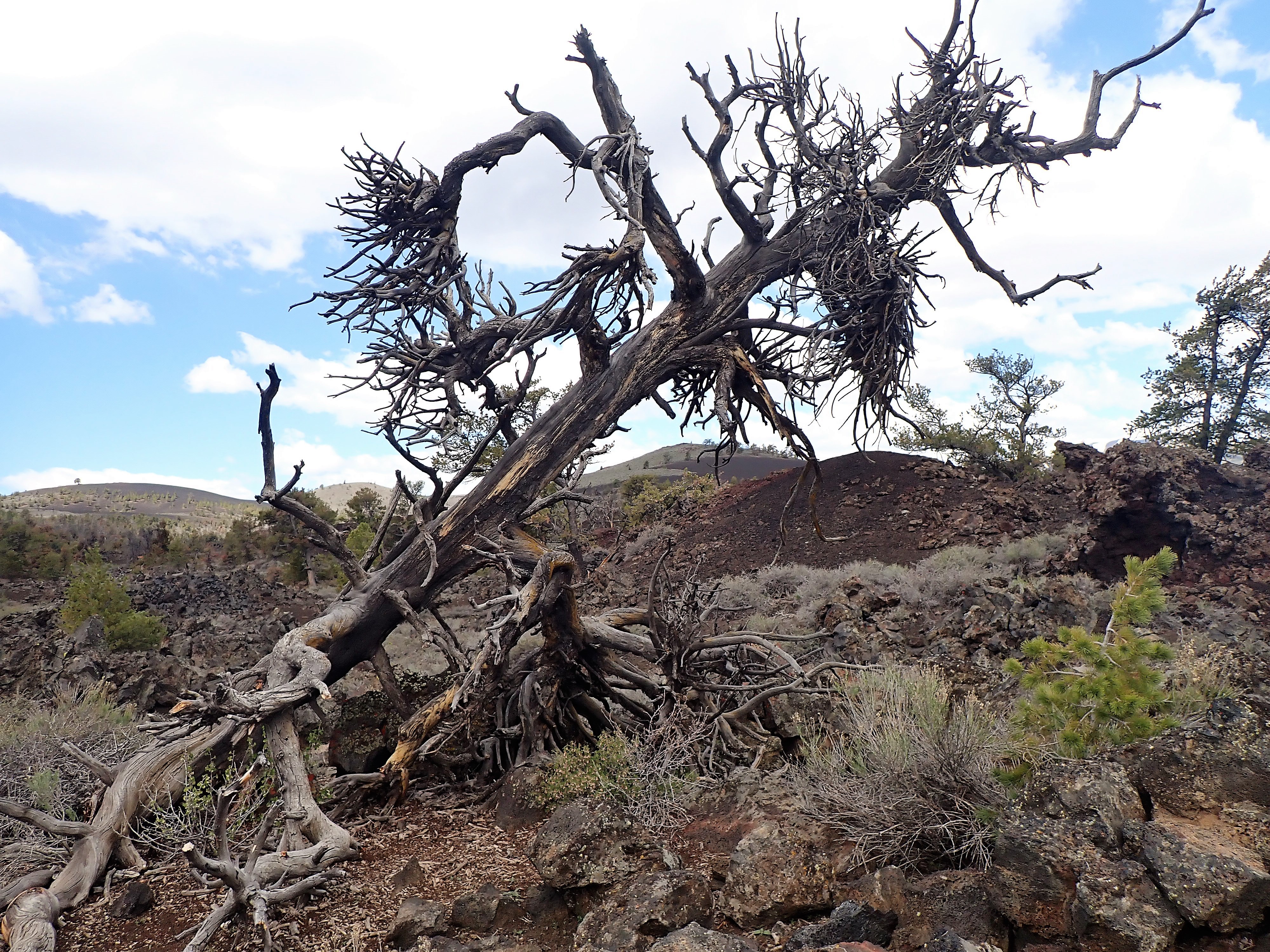
I really wanted to see Theodore Roosevelt National Monument outside of Dickinson and Medora, North Dakota. This was a fantastic adventure. Using my senior national parks pass, I entered for free and took the loop drive in the southern section of the park.

I like this photo because in addition to the bison you can see how the terrain has changed in the distance

Right at the first pullover there were bison and a herd of wild horses! The park also features prairie dogs and painted canyons. The loop is partially closed due to rain washouts. It was all so beautiful and especially as the sun was starting to set.

Yes, they were this close to the roadway

Maggie was interested in the wild horses

Painted canyons

We made it into Montana the second day. We stayed in a nice motel in Glendive near the Yellowstone River. Side note: the restaurant at the River Inn has fantastic food and desserts.

Sunday's goal was to get across Montana. I also decided to get off I-94. We took State 200 which followed the Lewis & Clark route. Honestly I think there are many Lewis & Clark routes.

This took us through what I called the Montana badlands...ravines and stretches of open pasture. There are no crossroads on 200S. There are only drives to ranches. There are mule deer and cattle.

The terrain changes to pine trees then to mountains. This route has very nice rest areas that are well maintained. From Great Falls to Missoula we ended up in the Blackfoot River Gorge. A beautiful drive down in to Missoula, Montana. We were to drive many river gorges on this trip.

Maggie's first time out on harness and leash and she did great

Finally mountains

We spent the night in Missoula. With the gain in an hour (mountain time) it was still light so I went for a run and found a tap room called The Dram. This name has some history for me as it was the bar in the old Guthrie Theater. Missoula is on the Clark Fork (river). It is also a college town.

Monday morning while packing up the car, Maggie escaped from the hotel room! Our room was right on the parking lot which was right on the street. There were a few minutes of panic but a couple a few doors down helped corral Maggie in their room.

Day four, Monday, is when my lost progress on the first day caught up to us. I also needed to decide which route we would take. A faster route would be to go through Bend, Oregon and down 97. This was a route I had already been on just last summer. It also might mean going through mountains with more snow than I had encountered already.

I decide to go through Portland and down I-5 through nearly the full length of Oregon. But I get ahead of myself. To get through the small section of Idaho we were going to hit, we drove down the Clark Fork Gorge. Dramatic is an understatement. The drive is very amazing and the entrance into Idaho is dramatic to put it mildly. The view of majestic snow-covered mountains though brief and on a very sharp curve is nonetheless worth it. I have no photos of this portion of the trip because all concentration was on driving.

Rest areas in Idaho were not nice. I wrote "yucky" on my notepad. From Idaho there is a long section of Washington state before you cross the Columbia River into Oregon. I haven't mentioned up to now but this time of year - mid-May brings so much color, lots of it green. And southern Washington has fields/pastures of blooming purples, pinks, red and yellows.

My unsuccessful attempt to get the Washington state fields

Next was Oregon and the decision to press all the way through to Ashland. Okay, the Columbia River Gorge is A-MAZ-ING! The other river gorges are narrow, curving, intricate and generally steep slopes with lots of trees. The Columbia River Gorge is wide with a very wide river but with sheer cliffs that block the sun and the Sirius XM satellite!

The south side of the Columbia River Gorge which is the road side

The north side with the Columbia River

Portland, Oregon lived up to its reputation of having awful traffic. This was my first big city and I had the bad fortune of driving through during rush hour. It was stop and go for miles.

Maggie all the while had been a trouper. She would look out the windows, sleep in her carrier, nap in my lap. Eat her treats, drink her water, and use her litter box. She enjoyed the motel rooms by walking from bed to night stand to chair to table to window sill to tv stand and back to bed. But the easy times had a bump in the road.

Typical daily nap in papa's lap

Many if not most restaurants closed by 7 or 9pm so getting a late supper was difficult. Monday's full throttle push to arrive in Ashland meant stopping for a quick meal at a Dairy Queen in Albany, Oregon. The drive-thru was the only option. Maggie was in my lap as we drove through and when I pressed the button to power-down the window, she freaked out. In my effort to not have her jump out the window, I grabbed her. The leap using her back feet clawed at my stomach and grabbing her caused her to bite my finger.

Without knowing all the damage, I ordered an ice-cream and french-fries. I pulled into a parking spot to investigate the damage. My t-shirt was shredded, and my stomach was slightly bleeding. My right hand and bitten finger were profusely bleeding. Fortunately, I had packed a first aid kit. I bandaged myself up and pressed on. Maggie eventually calmed down but could not bring herself to have any ice-cream.

To add to state capitols I stopped in Salem. While under renovation, it was still far better example of state capitols than was North Dakota's.

Oregon state capitol, Salem

We did make it to Ashland on Monday night.

The numbers below are mileage from my cars trip odometer and trip time (the amount of time the car is running so doesn't include when I stopped the car at rest areas, waysides, meals, etc.):

Friday - false start was 298 wasted miles - 4 hours 34 wasted minutes

Friday - productive 231 miles - 3 hours 50 minutes to Moorhead, Minnesota

Saturday - 514 miles - 9 hours 44 minutes to Glendive, Montana

Sunday - 513 miles - 8 hours 9 minutes to Missoula, Montana

Monday - 839 miles - 13 hours 49 minutes to Ashland, Oregon

Total west bound - 2105 miles and 36 hours and 18 minutes. The gas mileage averaged 21.9 mpg